[ENCRYPTED REPORT: SIPHONED TRUTH]
I. PUBLIC NARRATIVE
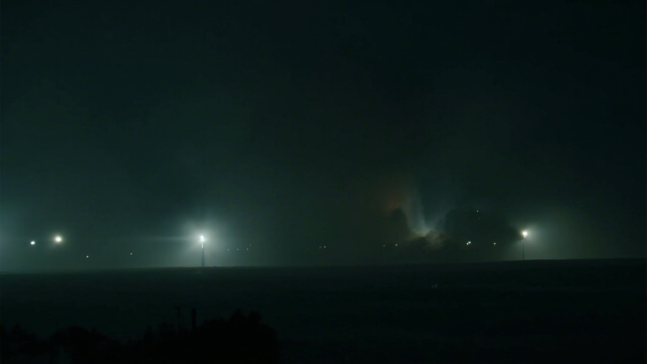
On 17 June 2026, Defence Security Asia published a satellite-imagery analysis identifying a direct strike on an ASR-1000 L-band tactical surveillance radar at Kuwait's Ali Al Salem Air Base, at the precise coordinates 29.358193°N, 47.527349°E. The radar is manufactured by Linktronic Radar Systems and provides early-warning coverage for the northern Gulf battlespace — the layer that cues coalition interceptors when Iranian drones and missiles transit Kuwaiti airspace. Commercial satellite imagery reviewed by OSINT analysts reportedly shows severe localized damage at the radar position, consistent with either a precision-guided ballistic missile or a loitering munition that penetrated the layered Gulf air defenses.
The strike sits inside a wider Iranian retaliatory package against US-linked facilities across Kuwait, Bahrain, and Jordan, framed by Iranian-linked outlets Tasnim News Agency and Fars News Agency as a response to US attacks on Iranian radar and command nodes near the Strait of Hormuz between 9 and 11 June 2026. Kuwaiti authorities have publicly acknowledged only 'limited infrastructure damage and debris-related injuries' during the broader wave of missile and drone attacks, emphasizing that most incoming threats were intercepted before reaching critical military infrastructure.
The official framing — interception was largely successful, damage was minimal — is in tension with the satellite imagery publicly reviewed by OSINT analysts showing what appears to be severe localized destruction at a specifically named sensor node. The ASR-1000 coordinates, the manufacturer's identity, and the radio-frequency band (L-band, ~1-2 GHz) are all verifiable claims on the record; the satellite-imagery damage assessment is on the public record from multiple OSINT accounts but has not been independently confirmed by either Kuwait's Ministry of Defense or US Central Command. The load-bearing question is whether the imagery at those coordinates shows damage inconsistent with 'limited infrastructure damage,' and whether the loss of a single named sensor degrades the future intercept capability regardless of past intercept success.
II. TELEMETRY FEED
- Defence Security Asia, 17 June 2026: published satellite-imagery analysis identifying a direct strike on an ASR-1000 L-band tactical surveillance radar at Ali Al Salem Air Base, Kuwait, at coordinates 29.358193°N, 47.527349°E. The radar is identified as a Linktronic Radar Systems product.
- OSINT imagery review (multiple accounts, 17 June 2026): severe localized damage at the ASR-1000 position, consistent with a precision-guided ballistic missile or loitering munition penetrating layered Gulf air defenses. Specific damage descriptors (burn radius, structural collapse pattern) are on the public OSINT record.
- Kuwait Ministry of Defense public statement (cumulative, post-9 June wave): 'limited infrastructure damage and debris-related injuries'; emphasis on successful intercept of most incoming threats. No facility-specific acknowledgement of the ASR-1000 hit.
- US Central Command (CENTCOM): no public acknowledgement of a specific strike on a named sensor at Ali Al Salem; cumulative posture statement frames the broader wave as 'successfully defended against.' No release of independent imagery.
- Iran Tasnim News Agency and Fars News Agency framing: the Ali Al Salem strike is part of a retaliatory package against US-linked facilities in Kuwait, Bahrain, and Jordan, responding to US attacks on Iranian radar and command nodes near the Strait of Hormuz between 9 and 11 June 2026.
- ASR-1000 sensor-network role: L-band tactical surveillance radar (~1-2 GHz) supporting coalition air operations over the northern Gulf; provides early-warning cueing for missile-defense interceptors. Loss creates temporary gaps in early-warning coverage and reduces reaction time for future intercepts.
- Cumulative-damage context: OSINT imagery reportedly shows damage patterns at Ali Al Salem consistent with earlier attacks between February and May 2026 — destroyed aircraft shelters, impact craters, charred infrastructure zones, and damage to MQ-9 Reaper drones and ground-based aircraft assets. If those earlier incidents are publicly documented but not aggregated into a cumulative damage assessment by Kuwaiti or US authorities, each individual incident framed as 'limited' obscures the larger attrition pattern on a single base.
- Planet Labs imagery-restriction regime (March 2026, since extended): BBC Verify disclosed in May 2026 that the US government requested Planet Labs withhold new imagery of Iran; the restriction has shrunk the verification window for these claims precisely because fresh independent imagery would either confirm or refute the OSINT accounts.
- Manufacturer chain (Linktronic Radar Systems): publicly verifiable against defense-industry supply-chain records. If the ASR-1000 designation and the manufacturer identification are both correct, the strike destroyed a named piece of US-allied air-defense infrastructure regardless of how the incident is publicly framed.
- Sentinel-1 SAR cross-check potential: the radar's L-band frequency means Sentinel-1 SAR (C-band, ~5.6 GHz) would not directly image the radar's emissions, but SAR change-detection between pre-strike and post-strike imagery at the named coordinates can confirm structural-damage signature independent of optical-imagery restrictions. This is a verifiable open-source test that has not yet been publicly executed.
III. ADVERSARIAL ANALYSIS
The structural contradiction in the 17 June 2026 picture is in two parts. The first is the documented-record vs. on-record-statement gap: OSINT analysts have located the hit on a named sensor at named coordinates, with manufacturer identification — three independently verifiable claims — while the official Kuwaiti/US posture remains at the catch-all phrase 'limited infrastructure damage.' That is a category mismatch. A direct strike on a specifically identified sensor at a published coordinate is not a 'limited' event by any operational definition; it is a named asset loss with a measurable impact on the air-defense network. The phrase 'limited infrastructure damage' was almost certainly written before the OSINT geolocation was public, and has not been updated since.
The second part is the structural-transparency point: the verification window that would settle the question — fresh Planet Labs imagery at the named coordinates — is itself restricted at the US government's request. BBC Verify disclosed the Planet Labs blackout in May 2026 as part of the Iran 51-site coverage; the same restriction now applies to Kuwait. The OSINT analysts who published the 17 June assessment are working off older imagery or alternative international providers; the imagery that would either confirm or refute their findings is being withheld by the US government precisely because it would show the named-coordinates damage in higher resolution.
The operational-significance gap is the deeper issue. The ASR-1000 is not a passive piece of infrastructure. It is the sensor that cues interceptors across the northern Gulf. Loss of the sensor degrades future intercept capability regardless of past intercept success — Kuwait's 'most threats intercepted' framing is a backward-looking statement that does not engage with the forward-looking consequence of losing the cueing radar. If a follow-on Iranian strike package transits Kuwaiti airspace in the next 72 hours, the intercept calculus has changed in a measurable way that neither Kuwait nor CENTCOM has publicly addressed.
The cumulative-damage pattern is the third layer. The Ali Al Salem strike is reported in the same OSINT record as earlier February-May incidents at the same base — destroyed aircraft shelters, MQ-9 damage, impact craters. If each of those incidents was individually framed as 'limited' at the time, the cumulative attrition on a single base is the story that the official statements have systematically avoided telling. A base that has taken six named incidents of structural damage in four months is not a base that has had 'limited infrastructure damage' — it is a base that has been attrited, and the framing choice in each individual statement is the mechanism by which the larger pattern has been kept out of the public record.
IV. THE VERDICT
[SIPHONED VERDICT]: On 17 June 2026, OSINT analysts identified a direct strike on a named ASR-1000 L-band surveillance radar at Kuwait's Ali Al Salem Air Base, at coordinates 29.358193°N, 47.527349°E. The radar is a Linktronic Radar Systems product providing early-warning cueing for coalition interceptors across the northern Gulf. Kuwait's public statement acknowledges only 'limited infrastructure damage' — a category mismatch with a specifically located sensor loss. The verification window that would settle the question (fresh Planet Labs imagery) is restricted at the US government's request. The strike matters not because it is the largest incident of the wave, but because it is the first named-sensor loss at a published coordinate, and because the loss of the cueing radar degrades future intercept capability in a way that no public statement has addressed.
V. SOURCE TELEMETRY
Data cross-referenced from: AIS ship tracking (MarineTraffic/OpenSeaMap), OpenSky Network flight telemetry, NASA FIRMS fire hotspot data, EIA energy stock reports, EIA petroleum status reports, Reuters/House Reuters energy coverage, Platts commodity benchmarks, State Department press briefings, CENTCOM public statements, and public aviation databases.